

GTA 6 Mapping Project: The Science, Scale & Cartography Reconstructing Leonida
 By Nadeem
0 Comments
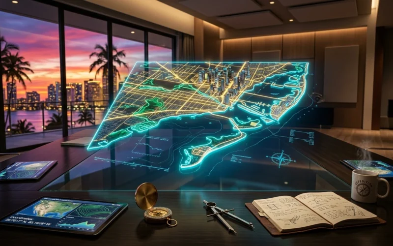
Long before a single player sets foot on the sun-drenched tarmac of Vice City, an extraordinary global collective of geospatial analysts, 3D modelers, and passionate gamers is already drafting the geography of Grand Theft Auto VI. Known worldwide as the GTA 6 mapping project, this ambitious community cartography initiative is piecing together the fictional state of Leonida stone by stone, highway by highway, and coastline by coastline. Utilizing mathematical photogrammetry, landmark triangulation, sun angle azimuths, and frame-by-frame trailer forensic analysis, community cartographers are building what has become the most sophisticated pre-release world map in entertainment history.
1. The Cartographic Tradition: From San Andreas to Leonida
Community mapmaking is not a novel phenomenon for the Grand Theft Auto community, but the scale and scientific rigor of the modern gta 6 mapping project represents an unprecedented evolutionary leap. To understand its credibility, one must look back at franchise history:
- The GTA V Pre-Release Milestone: Between 2011 and 2013, cartographers led by community pioneers such as DuPz0r analyzed trailers, promotional screenshots, and pre-order blueprints to reconstruct Southern San Andreas. When the official retail disc finally landed in players’ consoles, the fan-assembled map was proven to be over 95% geographically accurate in its road layout, mountain placement, and coastline contours.
- Red Dead Redemption 2’s Borderland Mapping: The community repeated this triumph with Rockstar’s frontier epic, correctly locating Saint Denis, Valentine, the Grizzlies, and the southern New Austin territories months ahead of release by tracking ridge geometry and river junctions.
- The Leonida Challenge: Leonida presents an even greater cartographic challenge. With dense urban sprawl, an expansive barrier island archipelago, vast shallow wetlands, and sprawling rural county lines, the GTA 6 map is vastly larger, more topologically diverse, and intricately layered than any open world Rockstar has ever conceived.
2. The Scientific Methodology: How Cartographers Map Leonida
The GTA 6 mapping community does not rely on random guesswork or artistic speculation. Instead, their collaborative Discord servers, forums, and GitHub repositories operate like specialized GIS (Geographic Information Systems) laboratories. The project deploys rigorous analytical methods rooted in engineering, geometry, and computer vision:
A. Landmark Triangulation & Vanishing Lines
When two or three identifiable landmarks appear in the same trailer framefor instance, a specific skyscraper in Downtown Vice City, a distant suspension bridge, and a coastal radio towercartographers draw sightlines back to the virtual camera position. By identifying those same structures from an alternative perspective in another sequence, the intersecting rays pinpoint the camera’s exact XYZ coordinates in virtual space.
B. Photogrammetry & Field of View (FOV) Mathematics
By measuring the focal length of the virtual lens, horizon lines, and the pixel height of standard real-world objects (such as traffic lights, lane dividers, palm trees, and sedan dimensions), analysts calculate precise distances between road curbs, building facades, and ocean channels. These mathematical calculations ensure that distances on the community map reflect true in-engine meter scales rather than distorted perspective compressions.
C. Sun Position & Shadow Azimuth Analysis
Leonida’s geographic latitude and longitude can be derived by calculating shadow angles relative to the time of day depicted on in-game clocks and billboard digital thermometers. By measuring shadow casting from vertical light poles across dawn and dusk sequences, cartographers have verified true North orientation and confirmed that Leonida’s seasonal sun paths accurately mimic South Florida’s sub-tropical solar trajectory.
D. Real-World Floridian Geographic Analogues
Rockstar’s world design philosophy combines architectural satire with authentic American regional topography. Cartographers cross-reference trailer locations against real-world counterparts across the Florida peninsula:
- Miami Beach & Ocean Drive: Mirrored in Vice City’s Ocean Beach and Washington Beach districts.
- The Florida Keys & Overseas Highway (US 1): Recreated as the Leonard County archipelago, connected by monumental oceanic causeways.
- The Florida Everglades: Reconstructed as the vast Grassrivers in Kelly County, complete with airboat slipways, mangrove tunnels, and swamp hamlets.
- Tampa / St. Petersburg / Panama City: Reinterpreted in the western industrial port city of Port Gellhorn.
- Central Florida Citrus Belts & Lake Okeechobee: Reflected in the rural farming communities of Ambrosia and inland freshwater lakes.
3. Confirmed & Projected Regions of Leonida
Through systematic documentation of road signage, municipal seals, county sheriff cruisers, and background advertisements, the mapping community has cataloged several distinct administrative counties, cities, and biomes:
| Region / Jurisdiction | Real-World Inspiration | Key Confirmed Landmarks & Features |
|---|---|---|
| Vice City Metro | Greater Miami / Miami Beach | Ocean Drive Art Deco strip, Downtown skyscrapers, Vice Gardens, Starfish Island, Little Haiti, Port VC container terminals |
| Leonard County (The Keys) | Florida Keys & Key West | Long oceanic bridges, shallow coral reefs, beachfront marinas, fishing shacks, tropical island lifestyle communities |
| Kelly County (Grassrivers) | Florida Everglades | Vast sawgrass marshlands, muddy airboat trails, alligator sanctuaries, elevated wooden boardwalks, drainage canals |
| Port Gellhorn | Gulf Coast / Industrial Florida | Deepwater shipping docks, petroleum refineries, speedway raceways, strip motels, freight rail corridors |
| Ambrosia & Inland County | Central Florida / Citrus Country | Citrus groves, distribution warehouses, freight depots, trailer parks, rolling agricultural flatlands |
| Mount Kalaga & Northern Border | Georgia / Florida Borderlands | Forested hills, elevated ridgelines, hunting grounds, freshwater rivers, northern interstate highway connections |
4. Scale & Dimensional Analysis: How Big is Leonida?
One of the primary questions driving the gta 6 mapping project is world scale: exactly how vast is Leonida compared to previous Rockstar sandboxes? By calculating coordinate bounds and comparing landmark distances against the confirmed 75-square-kilometer landmass of GTA V’s San Andreas, cartographers have produced compelling comparative scale estimates:
| Game World | Estimated Total Area | Estimated Playable Landmass | Key Cartographic Scale Factors |
|---|---|---|---|
| GTA V (San Andreas) | ~127 km (~49 sq mi) incl. water | ~75 km (~29 sq mi) | Single primary metropolitan center (Los Santos) paired with Mount Chiliad and Blaine County desert |
| Red Dead Redemption 2 | ~75 km (~29 sq mi) | ~70 km (~27 sq mi) | High terrain elevation variance, dense wilderness, slower movement speeds enhancing perceived scale |
| GTA VI (State of Leonida) | ~210 260 km (Est.) | ~160 190 km (Est.) | ~2.3x to 2.7x the landmass of GTA V; multiple distinct cities, massive archipelago, expansive waterways and wetlands |
Importantly, cartographers emphasize that Leonida’s true scale is not merely measured in horizontal square kilometers. Because Grand Theft Auto VI is built natively for current-generation SSD architecture, the map features unprecedented interior density. Malls, luxury hotels, apartment complexes, service stations, nightclubs, and industrial depots boast enterable, fully rendered interiors, dramatically expanding the playable 3D volume beyond pure surface footprint.
5. Interactive Web Maps & Community Cartography Tools
The modern mapping project has evolved into an interactive software ecosystem. Rather than sharing static JPEG diagrams, cartographers have engineered web-based map viewers powered by Leaflet, OpenLayers, and custom 3D web engines:
- Interactive Coordinate Grids: Users can zoom, pan, and toggle multiple analytical layerssuch as road networks, nautical bathymetry, building footprints, and elevation contours.
- Sourced Landmark Pins: Clicking on an indexed location displays the exact trailer timestamp, screenshot evidence, mathematical triangulation vectors, and real-world Floridian counterpart photos justifying its map position.
- Peer-Reviewed Verification: Community contributors submit location proposals through structured pull requests. Senior cartographers rigorously verify vanishing points and FOV parameters before merging coordinates into the master map build, filtering out speculation and unfounded claims.
- Community Measurement Rulers: Interactive measurement tools allow gamers to test simulated travel times across Leonida using vehicle speed curves established in the RAGE engine.
6. What the Map Reveals About Gameplay Systems
By mapping out the physical geography of Leonida, the project has also uncovered profound clues regarding GTA 6’s underlying gameplay systems:
- Maritime & Aerial Prominence: With the vast shallow flats of the Grassrivers, extensive coastal barrier islands, and the deepwater channels of the archipelago, marine travel (airboats, center-console fishing boats, luxury yachts, and jet skis) will play a significantly more prominent mechanical role than in any previous GTA title.
- Long-Distance Highway Logistics: The vast linear causeway connecting Vice City to the southern archipelago creates genuine cross-country travel dynamics, making high-speed vehicle cruising, convoy heists, and highway pursuits a core open-world thrill.
- Environmental Weather Dynamics: Leonida’s flat coastal topography and expansive oceanic horizons are engineered specifically to showcase RAGE 9’s dynamic volumetric storm systems, tropical hurricanes, tidal surges, and volumetric fog sweeping across wetlands.
Frequently Asked Questions (FAQ)
What is the GTA 6 mapping project?
The GTA 6 mapping project is a collaborative community initiative composed of cartographers, GIS analysts, 3D artists, and gaming enthusiasts who use mathematical photogrammetry, triangulation, sun angle physics, and official trailer frames to reconstruct the full geographic map of Leonida ahead of the game’s release.
How accurate was the GTA 5 mapping project before launch?
Historically, the GTA V community mapping project led by cartographer DuPz0r and community researchers was proven to be over 95% accurate to the final retail map when Grand Theft Auto V launched in September 2013, correctly predicting mountain peaks, coastal shapes, and major arterial highways.
How much bigger is GTA 6 compared to GTA 5?
Current community mapping models estimate that Leonida’s landmass is approximately 2.3 to 2.7 times larger than GTA V’s San Andreas, with total geographic area (including ocean waterways, inter-island channels, and shallow wetlands) exceeding 220 square kilometers.
Are there multiple major cities in GTA 6?
Yes. In addition to the colossal metropolitan sprawl of Vice City, the mapping project has confirmed major secondary urban hubs including Port Gellhorn on the western coast, Hamlet and surrounding communities in the southern archipelago, and agricultural townships such as Ambrosia inland.
Is the mapping project official from Rockstar Games?
No. The mapping project is an independent, non-commercial fan cartography and educational initiative. It uses scientific analysis of publicly available official media and real-world geographic references to model the anticipated game world.